UN
Hickling
£ 212,000
Description
We don't have a Description for this property.
- Bedrooms
- 3
- Bathrooms
- 0
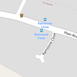

Leaflet © OpenStreetMap contributors
The heatmap indicates the level of crime in the area. The color of the heatmap indicates the crime severity and recency.
Metrics Year-on-Year
- Average area value
- 278,019.00 £Increased by 21.15 %
- Average area rental value
- 919.00 £/moDecreased by 8.01 %
- Est rental Yield
- 3.97 %Decreased by 23.95 %
- Crime Rate
- 29.00 %Unchanged by 0.00 %
from 229,480.00 £
from 999.00 £/mo
from 5.22 %
from 29.00 %
Nearby Schools
| Name | Type | Ofsted | Distance |
|---|---|---|---|
| Smeeth Community Primary School | Foundation School | Requires improvement | 0.90 KM |
| Brabourne Church Of England Primary School | Voluntary Controlled School | Good | 2.13 KM |
| Caldecott Foundation School | Non-maintained Special School | Good | 2.62 KM |
| Sellindge Primary School | Community School | Outstanding | 3.70 KM |
| Aldington Primary School | Foundation School | Good | 4.80 KM |
Images
Nearby Streets
| Name | Average Price | Average Sqft | Distance |
|---|---|---|---|
| The Chestnuts | £ 430,000 | 0 | 0.00 KM |
| Lilyvale Road | £ 0 | 0 | 0.00 KM |
Nearby Transport
| Name | NLC | TLC | Distance |
|---|---|---|---|
| Westenhanger | 5030 | WHA | 7.65 KM |
| Wye | 5031 | WYE | 8.55 KM |
Nearby Listings
| Address | Price | Type | Score | Distance |
|---|---|---|---|---|
| Plain Road, Smeeth, Ashford, Kent, TN25 | £ 350,000 | BUY | 6 / 10 | 0.09 KM |
| Canterbury Road, Brabourne Lees, Ashford, Kent, TN25 | £ 500,000 | BUY | 5 / 10 | 0.12 KM |
| Plain Road, Smeeth, Ashford, Kent, TN25 | £ 315,000 | BUY | 7 / 10 | 0.14 KM |
| Knatchbull Way, Ashford, Kent, TN25 | £ 399,500 | BUY | 7 / 10 | 0.15 KM |
| Knatchbull Way, Brabourne Lees, Ashford, Kent, TN25 | £ 415,000 | BUY | 7 / 10 | 0.21 KM |
Nearby Properties
| Address | Price | Distance |
|---|---|---|
| Hickling | £ 212,000 | 0.00 KM |
| Spring Field | £ 460,000 | 0.00 KM |
| Crail | £ 340,000 | 0.00 KM |
| The Culvert | £ 245,000 | 0.00 KM |
| Whispers | £ 220,000 | 0.00 KM |